Position: Head of project.
Recipients: Guadalquivir River Basin Authority. Hydrologic Planning Office. 2019.
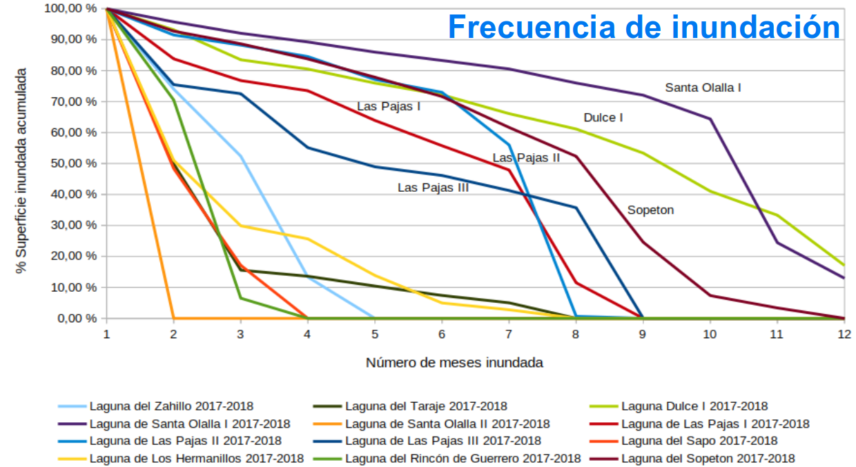
The work carried out corresponds to the update, until November 2018, of the series of data to monitor the evolution of the flooded surface and vegetation in the Doñana lake-type water bodies, derived from remote sensing, and more specifically:
- Determination of the frequency of flooding and analysis of the evolution of the extension of the water surface in the study period, from the water index (MNDWI), derived from satellite images and its relationship with the rainfall data.
- Evolution of vegetation from the vegetation index (NDVI) derived from satellite images for the study period.
- Images from the Sentinel 2 satellite have been used, and an image has been selected for each of the months.